Getting to Havasu Falls is no easy task. Some planning is necessary to enjoy some of the most beautiful scenery in the world.
Havasu Falls Trailhead – Hualapai Hilltop
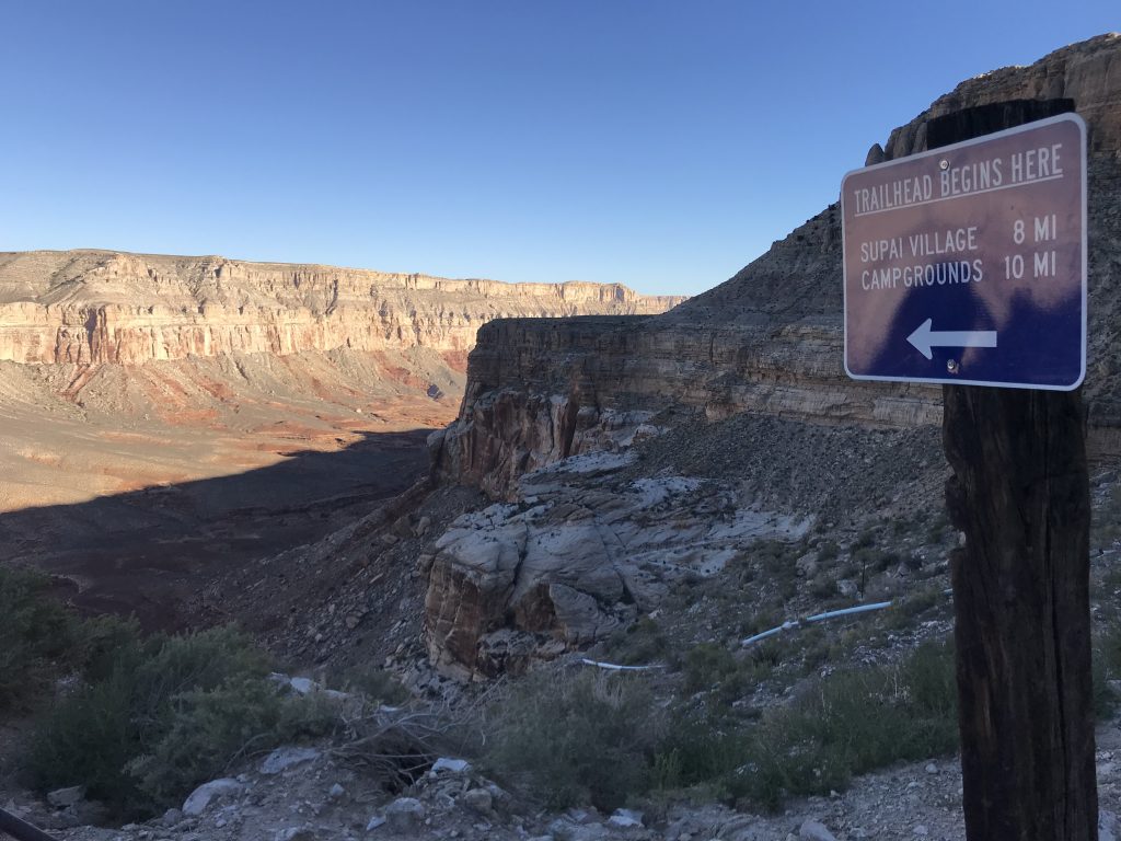
All adventures to Havasu Falls begin and end at Hualapai Hilltop (the Havasu Falls Trailhead) or just “Hilltop”. The trailhead is in a remote location not easy to find if you don’t have good directions and hours from good cellular service. So, print these Havasu Falls Trailhead directions and have a map handy. New signage on the roads has made it a bit easier to navigate to the Havasu Falls Trailhead.
Closest Airports to Havasu Falls
The closest airports to the Havasu Falls Trailhead are:
- Phoenix, AZ (PHX)
- Las Vegas, NV (LAS)
Please note: Havasu Falls Trailhead is about 90 minutes from any food, water, gas, or cell service. There is no water at the Havasu Falls Trailhead. Before turning onto Indian Road 18 from old route 66, make sure you fill up on gas and have water for your hike in. There is no gas, water, or cell service once you’re on Indian Road 18.
Havasu Falls Trailhead From Phoenix
Drive Time: 4.5 hours
Lodging: We recommend staying as close to the trailhead as possible so you can get an early start the next morning. The closest lodging to the trailhead is on AZ-66 before the turn onto Indian Road 18. Indian Road 18 has no cell service, gas stations, food, or lodging.
Directions:
- Drive north on I-17 and exit onto AZ-69 N at Exit 262 toward Prescott.
- After 21 miles merge onto AZ-89 toward Chino Valley.
- Continue on AZ-89 to I-40 and go west on I-40.
- Take the I-40 Business Exit, Exit 123, toward AZ-66/Seligman/Peach Springs.
- Keep your eye out for Indian Road 18 heading to the right (north), and turn onto it.
- Follow Indian Road 18 for approximately 60 miles, where the road ends at Hilltop (the trailhead).
Havasu Falls Trailhead From Las Vegas
Drive Time: 4 hours
Lodging: We recommend staying as close to the trailhead as possible so you can get an early start the next morning. The closest lodging to the trailhead is on AZ-66 before the turn onto Indian Road 18. Indian Road 18 has no cell service, gas stations, food, or lodging.
Directions:
- Take US-93 South from Las Vegas and follow it for 102 miles.
- At Kingman, merge onto I-40 E/US-93 S toward Flagstaff/Phoenix and stay on for 4 miles.
- Take the Andy Devine Avenue exit (Exit 53) toward AZ-66 E/Kingman Airport.
- Turn left onto US-93 Bus S (E Andy Devine Avenue) and continue to follow E Andy Devine Avenue.
- E Andy Devine Avenue becomes E Highway 66/AZ-66, and follow this for appx 50 miles.
- Watch for Indian Road 18 on your left. If you reach Grand Canyon Caverns Inn (on your right), you’ve driven past Indian Road 18.
- Follow Indian Road 18 for approximately 60 miles, where the road ends at Hilltop (the trailhead).